Maps of Onota Township
Geographic Information Systems (GIS)
Geographical Information System (GIS) maps of the county and township are available online for the public. These comprehensive map systems have selectable layers that allow the user to customize the display and information shown. Essentially, it is an online version of the Alger County plat book, showing land ownership. This site is best used on a device with a screen significantly larger than a smartphone (i.e. tablet, laptop, PC), because of the large sidebar shown with the map.
Note: The details provided are for information purposes only, and are subject to change due to property transfers and pending updates.
Viewing Onota Township parcels
TO ACCESS: Go to Colligo GIS for Alger County  (this link will open in a new window.
Click the  box to open the map.
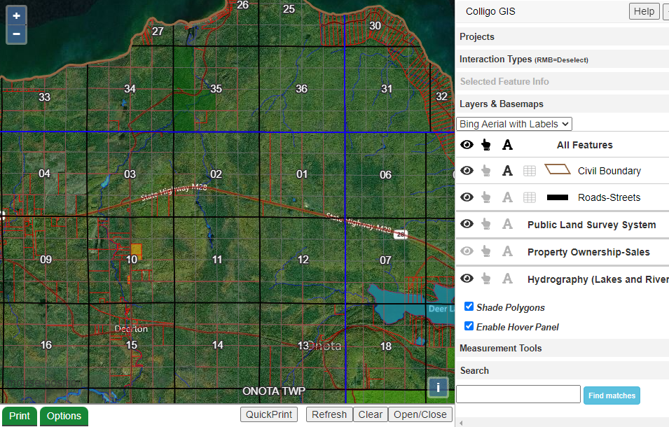
VIEW OPTIONS: The default view is a road map. For aerial imagery (as shown in the screenshot), change the view option on the right sidebar under “Layers & Basemaps” 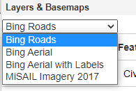 .
.
MAP USE: Click and drag to center the map over Onota Township.
To zoom in and view parcels, use the plus  button in the upper left corner.
This method is easiest, because the details box automatically opens for any parcel clicked on. You can also double-click to zoom, but it will result in unintended parcel selections.
PARCEL INFO:
(1) For an overview – hover over the parcel and a box will appear. This box shows basic info – ID number, owner, tax mailing address, property address, etc. For small parcels, you may need to zoom in closer so the software will recognize the parcel boundaries.
(2) For more info – click on the parcel. A box will automatically open over the bottom half of the map, listing available public details on the parcel selected. Use the scroll bar on the side of this box to see the legal description, assessed value, etc. Use the Open/Close button to minimize the this detail box.
HINTS:
*The hover box can be disabled by unchecking the option that says “Enable Hover Panel” on the right sidebar (just below Hydrography, as shown in the full screenshot)
*To de-select parcels, click the right mouse button or tap on a non-parcel area of the map (e.g. lakes).
*Parcel shading indicates ownership / tax status:
green – federal or state government
teal – county government
yellow – city or township government
red – commercial forest reserve (PILT) (MI DNR info sheet on CFR ![]() ).
).
Other Area Maps
- US Geological Survey topographical maps: View online (USGS , MI DNR ).
- Alger County plat book (hard copy of GIS data): Purchase at the county courthouse or MSU extension office (located at the county health department building.
- Road maps (Michigan Dept of Transportation): online interactive map ) (shows closures, incidents & construction zones – updated frequently) or free at Michigan roadside rest areas.
- Historical maps: available to view at area museums and historical centers.